WATER LEVEL 

The references to the water level in all the web site, are read at the water gauge of Malè, situated 20 m. upstream from the bridge that from the village centre, takes to the sport field zone; very visibile passing along the cycle track, leaning out.
[button size=”normal” type=”inverse” value=”until 30 —->” href=””] Impassable
[button size=”normal” type=”info” value=”from 30 to 50 –>” href=””] Medium-low level, ideal for beginners; to 50 is sufficient also for the raft
[button size=”normal” type=”primary” value=”from 50 to 80 –>” href=”#”] Optimal level,sure fun !!
[button size=”normal” type=”warning” value=”from 80 to 120 ->” href=”#”] High level; for paddlers with one sure experience
[button size=”normal” type=”danger” value=”over 120 —–>” href=”#”] Thought to risk
References are derived from personal experiences and have an indicative value only; no responsibility can be attributed to the Canoe Club, as everyone has to deal with the technical and personal experience.
Available sensor in real time :
| Sensore - Data - Ora - Livello (mt) | |
|---|---|
Special thanks to Ufficio Dighe Provincia Autonoma di Trento, that provides data More details
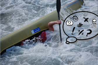
View from the viaduct of Malè, about the “S” before the “millebuchi rapid” with different level


Statistical corse level Noce river in last 15 years
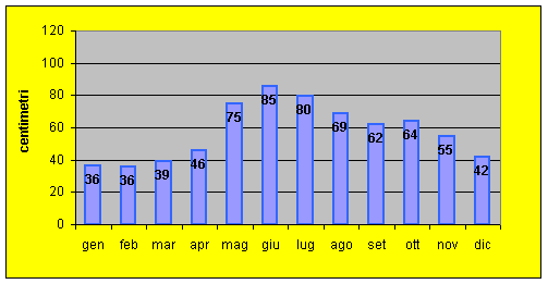
Source given: dams office of Provincia Autonoma di Trento